Camilla and I were recently at one of our local breweries, Great Baraboo Brewing Company, partaking in their excellent half-off-pizza-on-Mondays deal, when a beer caught my eye: the Cady’s Corner IPA.
Great Baraboo is rich with local history tie-ins, and this was one of them. For several decades in the 1800s, the spot where it now stands was a hub of commerce known locally as Cady’s Corner… or Cady Corner, or Cady Corners, or Cady’s Corners, depending on what you’re reading.
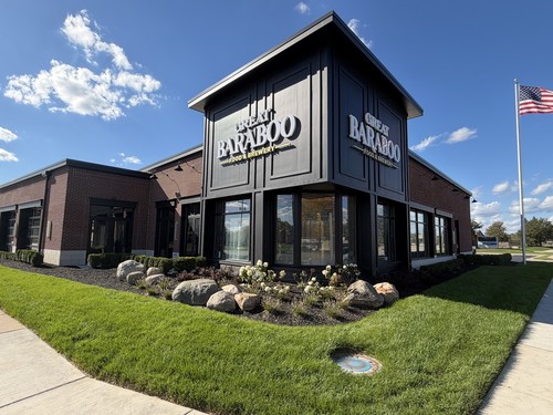
The internet is relatively silent on Cady’s Corner. I tried reaching out to Great Baraboo to see if they had any hidden knowledge, but their brewer, Chad Benigni, went back to the old brewer, Jeremy Altier, who’d named the beer in the first place, and returned to me empty handed.
“We don’t have any more information or history of the area besides the things I’m sure you’ve found online,” Chad said.
Those things online mostly consist of a paragraph in a Patch article, a short post from the local historical commission that’s mostly concerned with the anonymous writer’s personal connection, a stray mention on Clinton Township’s official website, and a few shallow, plagiarized details in the description of a geocache.
To see what I could add to the internet’s constellation of random information, I went over to the history room at the local library. It was hot in there, but I came away with some nuggets never put together in one place before. Later I got a big help from someone with a living connection to this history, which I’ll get into below. I also got one of Wikipedia’s errors confirmed by a township official.
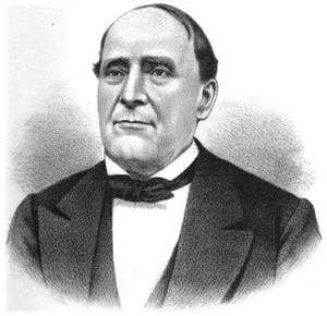
The one-time village of Cady’s Corner was named after Chauncey Goodrich Cady, who owned 190 acres in the immediate vicinity beginning in 1833.
Chauncey’s land lay along the oldest, most important road in the area: Moravian Drive, the “first interior road in Michigan.” It was cut through the woods 50 years earlier, during the Revolutionary War, to connect a band of missionaries to the fort town of Detroit. The missionaries were German-speaking members of the Moravian movement who managed to briefly set up a nice little village called New Gnadenhutten. It’s seen as the first European settlement in this area of Michigan.
Chauncey bought his land — 160 acres in present-day Sterling Heights and 30 acres in Clinton Township — when he was about 30 years old. His name became attached to the place sometime in the next three decades. On July 15, 1864, a post office opened there under the name of Cady. It seems like this post office, which shut down after 42 years, was the most official way that “Cady’s Corner” ever existed on paper.
It’s not clear exactly how the spot came to be called by Cady’s name, except that he was evidently a socially active man of means, a politician at the local and state level, and seems to have been well liked. Twelve years after his death, local historian Robert Eldredge described him as “very active in his later days in all pioneer gatherings, where his unfailing fund of anecdotes and keen wit and humor made him most welcome.”
So what was the place like when Cady got there, before it was Cady’s Corner? A glimpse is provided in a typewritten biography of Chauncey by Michael C. Buckley:
The Corners were apparently occupied with dwelling houses and business offices, and an embryo village of log and framed buildings, were known to have existed there before 1830. There were probably twelve to fourteen families there at the time, though many more travellers had made a temporary residence there.
Chauncey’s brother, Horace, had already started developing the corner before Chauncey even got there, according to Buckley:
In 1829, Horace Cady erected a building, which by several additions had grown into the Empire House at Cady’s Corners. The Empire House has been described by residents as a “large, respectable, hotel.” Until recently it was located on the northeast corner. The Corner was not then as prominent a place as it has since become, for the Shelby (Utica) Road was then a fact lying in the future, and the road (Moravian Drive) to Frederick (at Moravian Drive and Cass Avenue) lay by the place lately owned by A. C. Smith, onward to the bank of the Clinton River near the residence of A. Morross, and up the river to Frederick (Hillcrest Golf Course).
My view of Cady’s Corner dims until 1875, when it appears in an atlas of Macomb County. The label “CADY’S CORNERS” is on Clinton Township’s map, and the name C. G. Cady is written on the adjacent parcel in Sterling Township (now the city of Sterling Heights).
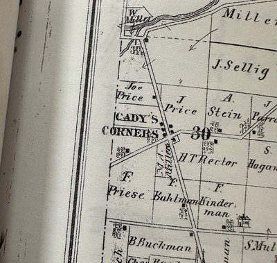
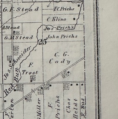
We can take a walk through Cady’s Corner as it stood four years later, in 1879, with the help of a charming piece written in 1983 by Ruth Baker for the Sterling Heights Genealogical and Historical Society:
Next, we’ll stop at Charles Faulman’s general store. Mr. Faulman sells Utica Mills flour, which everyone knows is the best, and he also handles Donaldson Brothers’ plows. How about ordering a new pair of custom-made shoes? Peter Johnson, whose shop is above the general store, sells at the lowest possible prices. And Mr. Huth, who used to live in Utica, owns the wagon and carriage shop nearby. Maybe he will let us watch him work.
Our last call will be at the “Farmer’s Home” to see John Dale. He keeps the only hotel at the corners and does his best to make customers feel at home. While we’re there, we can water the horses, and perhaps get a glass of sarsparilla [sic].
For a real testimony from 1882, around the same time as this imaginary walk, we have Macomb County historian M. A. Leeson (who puts the village’s origin later than Buckley did):
The village of Cady, or Cady’s Corner, is a small settlement composed chiefly of German farmers and their families, dating from 1834. It is on the Clinton River, in the center of a rich agricultural region, about seventeen miles above Detroit, five southwest of Mt. Clemens, the county seat, and near Fraser Station, on the Grand Trunk Railway, to which depot goods should be shipped. It has a German Lutheran Church and common school.
A further 23 years later, one year short of the Cady post office shutting down, the historian Eldredge described the place in these terms:
Cady is the postoffice of a settlement that grew up around the crossing of the Detroit & Utica Plank Road by the River Road from Mt. Clemens through Frederick to the southwest part of the county. It was so named because the residence of Chauncey G. Cady was near by. It has for years had a store and tavern, and for sometime a milk station, which has afforded an additional drawing card for the surrounding families.
Some tidbits from the short 20th-century life of Cady’s Corner are provided by an anonymous writer on the Clinton Township Historical Commission’s website:
Shortly after selling their farm in early 1900, Charles and Christina Wellhausen purchased a small general store in a nearby village known as Cady’s Corners. They gave this store to my great-grandparents George and Amelia who ran it. This was much less taxing on George’s health than farming had been. George and Amelia ran this General Store until 1905. … My grandmother always spoke of Cady’s Corners to me. She told me that their General Store was on one corner and a “beer garden” as she always referred to a bar was on another corner.
The post office shut down on July 31, 1906. Chauncey Cady himself died on Dec. 10, 1893. His surname was apparently still visible on maps as late as 1983, because in Ruth Baker’s imaginary walk, she wrote that if you “look at an up-to-date map of Macomb County and you will find, at the crossroads of Moravian and Utica Roads, the name ‘Cady.’”
Today, the name Cady signifies nothing. I’ve never heard anyone refer to this area as any variant of “Cady’s Corner.” Still, at the time I’m writing this, Wikipedia counts “Cady” as an unincorporated community of Clinton Township, citing (1) this map that now leads to a 404 page and (2) federal government data from 1981, itself probably derived from outdated maps.
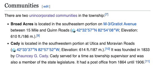
There’s no such thing, though, and the other “unincorporated community” Wikipedia mentions, “Broad Acres,” doesn’t exist either. They don’t appear in Clinton Township’s latest master plan, and the township’s director of planning and community development, Bruce Thompson, doesn’t know anything about them.
“Sorry have no idea and see no record of either,” he said by email.
One thing of Chauncey Cady’s very much still survives: the brick house he built on his property in Sterling Heights, at 35290 Moravian Drive. The house is hard to see from the road, hidden behind a wall of trees, but you can just glimpse it on Google Street View.
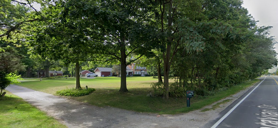
Chauncey sold the house in 1888, five years before his death at his daughter’s house in Detroit. Katie Decker, a granddaughter of the house’s current owners, provided me with an amazing PDF she put together of articles relating to the house and Chauncey. Among the papers was this description:
The house was built on a high sandy hill which gave it a towering view of the surrounding property. He built his homestead entirely of brick, with each wall in the house being three bricks thick. The bricks were baked in kilns located directly across the street from the house.
…
No history of Macomb County and especially Sterling Heights can be complete without including Chauncey Cady. His home, big and stately is indicative of the type of man he was.
The sources are a little hazy on the style of the house. The unidentified writer above describes it as having “rather 2 district [sic] styles; the exterior interior design was Federal, while the interior exterior floor plan was Greek Revival architecture style.” In 1983, Ruth Baker gave a somewhat different appraisal, citing this reference book:
The Cady house is an example of the Georgian style of American architecture, a style named after the kings of England who ruled from 1714 to 1830. It was popular mainly during the 18th century.
The features which establish it as Georgian in style are the gable roof; the plain, unadorned, rectangular exterior which is formal and symmetrical in arrangement. The ornately decorated entrance serves as the only decoration, except for the louvered shutters which are Federal in style. Georgian houses did not have shutters.
The side addition also is not typically Georgian in character.
The name Cady flickered back into existence during the 20th century with Cady Elementary School, which stood in the former area of Cady’s Corner. The internet seems to agree the elementary school closed some time in the early 1980s. The Cady name didn’t last even that long. By the time Buckley typed up his history, he reported that “the Chauncey Cady school has been successfully disguised - with demolition, renovation, additions - as the Einstein Elementary School” — presumably to match the Fraser School District’s theme: “Walt Disney Elementary,” “Thomas Edison Elementary,” “Mark Twain Elementary,” etc.
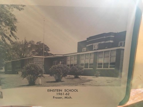
The building still saw some use after closing as an elementary school. A mom I know told me about her daughters and nephews going through preschool programs there, including one called Toddle Time, in the ’90s and early 2000s. Google Earth images pinpoint the demolition to the summer of 2005 and chart the ongoing decay of the old concrete.
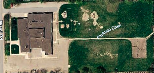
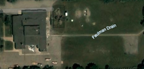
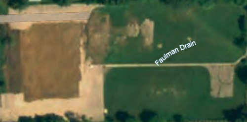
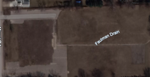
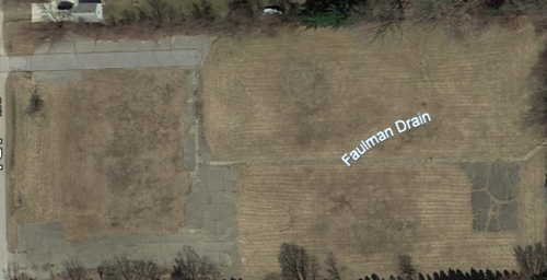
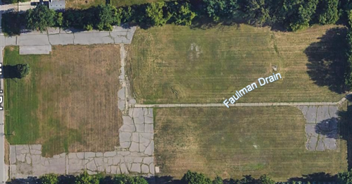
Here’s what it looked like on Sunday, Oct. 4, 2026:
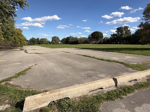
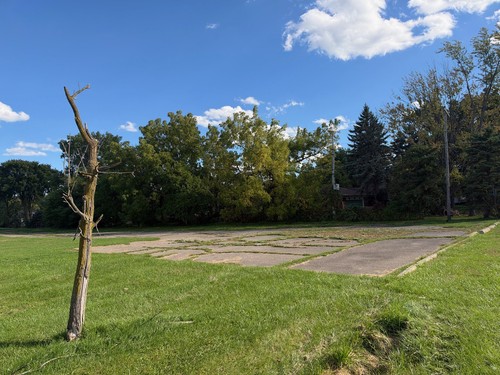
I’ll finish with a look at what’s going on at Cady’s Corner today. Michael C. Buckley described the old Cady’s Corner as a “rendezvous for many who, after recuperating and reconnoitering, started on expeditions to other parts of the county, or to the counties around,” and it remains a practical pit stop for people going elsewhere.
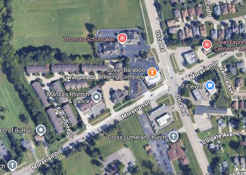
The main business is Great Baraboo at the northwest corner of Utica and Moravian. Going clockwise, the other corners hold:
- a liquor store,
- a gas station and 7-Eleven, and
- a gas station and a Lutheran church.
A cluster of medical practices lies to the north of Baraboo.
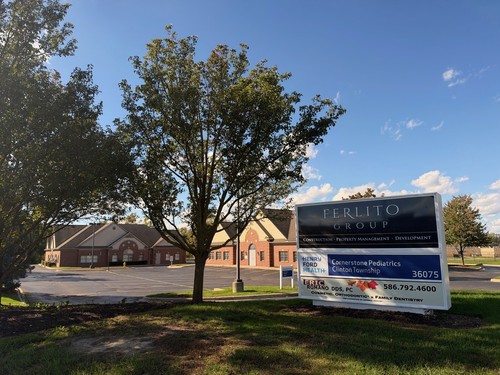
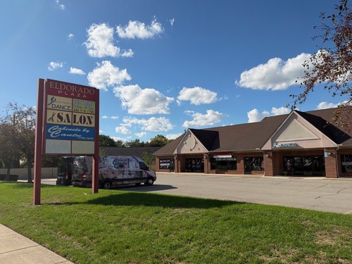
And to the west there’s a plaza with salons, a dance studio and a cabinetmaker.
Comments
Leave a comment